The Salzkammergut Hydrological Landscape
The Austrian Salzkammergut is one of the world's oldest culturally managed landscapes, recognized on the UNESCO World Heritage register for its seamless blend of natural beauty and more than 7,000 years of continuous salt extraction. The geology here is dominated by the Northern Limestone Alps, where karstified plateaus capture snowmelt, filtering it through porous stone before discharging crystal-clear water into deep basins.
Within this district, Wolfgangsee (also known as the Abersee) and Hallstätter See represent complementary expressions of alpine geography: one a broad, luminous recreational haven surrounded by alpine meadows and forested bluffs, the other a shadowed, steep-walled glacial trough resembling an enclosed mountain fjord.
Wolfgangsee: Recreation, Steam Navigation & the Schafberg
Sitting at 538 meters above sea level, Wolfgangsee covers approximately 13 square kilometers and is divided into two distinct basins by the narrow strait at the Falkenstein ridge. The water is celebrated for its exceptional quality, routinely tested at drinking-water grade with visibility frequently reaching down 10 meters.
The town of St. Wolfgang is home to the historic SchafbergBahn, a metre-gauge rack railway operating since 1893. Steam and modern diesel locomotives push vintage cars up a 5.85-kilometer gradient to the summit of the Schafberg at 1,783 meters. From the peak's edge, visitors can look down upon not only Wolfgangsee, but also Mondsee, Attersee, and several smaller tarns across the Salzburg and Upper Austrian borderlands.
Active Pursuits on Wolfgangsee
Because motorized personal craft are strictly limited by regional environmental laws, Wolfgangsee is exceptionally peaceful for open-water swimmers, stand-up paddleboarders, and dinghy sailors. The historic Kaiser Franz Josef I paddle steamer, launched in 1873, still cruises between St. Gilgen, Strobl, and St. Wolfgang throughout the summer season.
Pilgrimage and Trail Heritage
The historic Falkenstein Pilgrimage Trail crosses the rocky spine between St. Gilgen and St. Wolfgang. For centuries, pilgrims walked this steep forest path, which features rock chapels, bell-ringing shrines, and cliffside viewpoints overlooking the central lake basin.
Hallstätter See: Fjord-like Solitude and Deep-Water Limnology
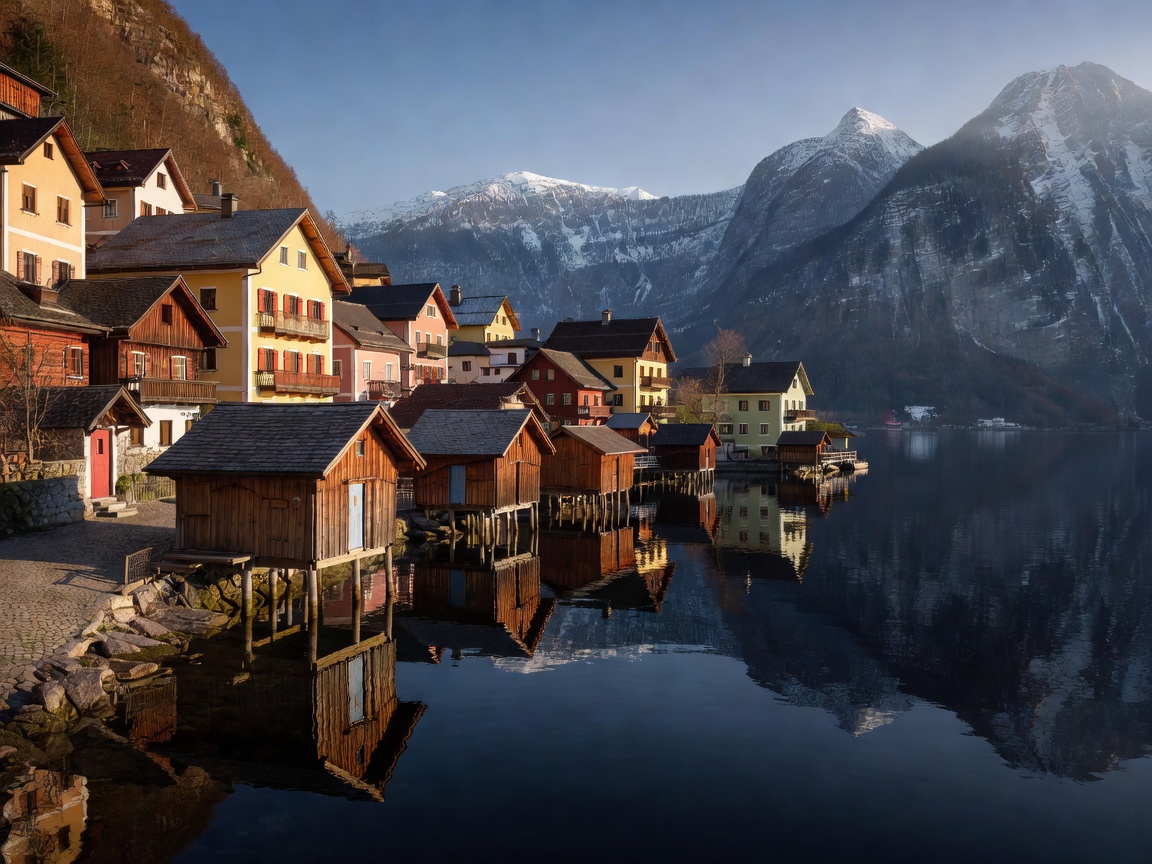
Lying approximately 25 kilometers southeast of Wolfgangsee, Hallstätter See occupies a narrow north-south glacial trench at 508 meters elevation. It reaches a maximum depth of 125 meters and is flanked to the west by the Plassen mountain and to the south by the high karst plateau of the Dachstein (2,995m).
Because the cliffs on the western shore plunge straight down into the lake, the historic village of Hallstatt was accessible for millennia only by boat or over steep, narrow mountain tracks. Today, the village center is designated a pedestrian zone, and visitors arriving by train disembark at Hallstatt station on the isolated eastern shore, boarding the historic ferry Stefanie to cross the deep lake directly to the town square.
Technical Diving & Winter Conditions
Hallstätter See’s cold, low-nutrient water offers extraordinary underwater visibility, making it a primary destination for technical cold-water scuba diving. Submerged tree structures, sheer vertical walls, and relic artifacts from centuries of timber transport rest preserved in the non-turbid depths. Because the high mountains block direct winter sunshine from parts of the lake for months, the water stays cool year-round, rarely warming beyond 19°C even in August.
Data Matrix: Wolfgangsee vs. Hallstätter See
| Characteristic | Wolfgangsee | Hallstätter See |
|---|---|---|
| Altitude | 538 m | 508 m |
| Surface Area | 13.0 km² | 8.55 km² |
| Maximum Depth | 114 m | 125 m |
| Water Quality | Drinking water standard • Class 1 | Oligotrophic • Exceptional visibility |
| Mountain Railways | SchafbergBahn (1,783 m) • Zwölferhorn Seilbahn | Salzwelten Funicular • Dachstein Krippenstein Seilbahn |
| Rail Connection | Bus link from Bad Ischl / Salzburg Hbf | ÖBB Train directly to Hallstatt Bahnhaltestelle |
Pros, Cons & Practical Advice
Advantages
- Unspoiled water clarity: Strict regulations against combustion engine noise make both lakes exceptionally serene for silent paddling.
- UNESCO cultural depth: Few alpine destinations combine glacial scenery with thousands of years of continuous salt-mining history and prehistoric archaeological finds.
- Extensive trail networks: From lakeside walks around the eastern shore of Hallstatt to rugged climbs up the Schafberg, route grades suit all fitness levels.
Challenges
- High tourist concentration in Hallstatt: The core village experiences heavy daytime tour groups between 10:00 and 16:00. Early mornings and evenings offer a dramatically more peaceful atmosphere.
- Chilly water temperatures: Hallstätter See remains bracing even in midsummer; casual swimmers typically prefer the warmer shallows of southern Wolfgangsee or nearby Mondsee.